

This week, Typhoon Maysak triggered severe flooding in Guangxi, a southern Chinese province bordering Guangdong. Days of torrential rain have left multiple people dead, and my social media feeds have been dominated by news of the disaster.
As a Beijing resident, the story hits close to home. The Beijing I remember was dry and hot. But since moving back in 2021, I've watched the city grow noticeably wetter. No year from my childhood was ever as rainy as the past two have been. And it’s not just my feeling. Last month, Caixin reported that Beijing’s average annual precipitation over the past decade has risen by twenty percent, with rainfall in 2025 exceeding 900 millimeters.
For anyone educated in China, that number calls to mind a concept from high school geography that Beijing sits right on the 400-millimeter isohyet—the line connecting places that receive 400 millimeters of annual rainfall. This line is about far more than weather. It marks the boundary between two ways of life that defined traditional China, between farming and nomadic civilizations. Beyond it, rainfall is too scarce to sustain agriculture, and people historically survived by herding instead. For that reason, successive Chinese dynasties treated the line as a natural defensive frontier.
Now, that line appears to be shifting. As a history enthusiast, I couldn't help wondering what this might mean, and I’m not the only one. Professor Wang Zhengxu of Zhejiang University has been thinking along the same lines. The other day, he shared with me an essay he wrote in 2023 about how rainfall shaped the social, political, and economic patterns of ancient China. I found it illuminating, and I'd like to share it with my readers here.
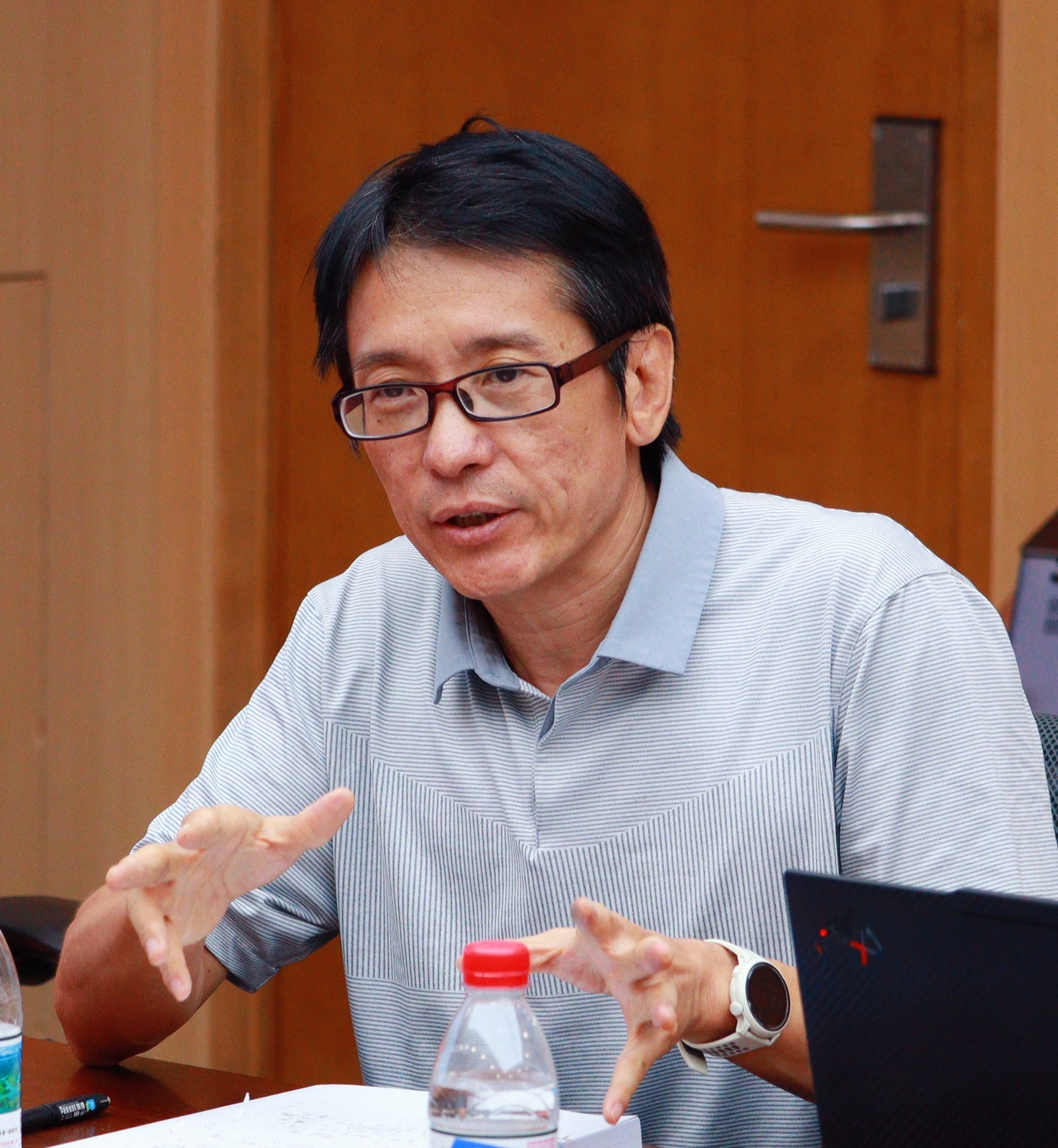
Professor Wang Zhengxu (王正绪) is a distinguished professor at the School of Public Affairs, Zhejiang University. Previously, he served as a distinguished professor at Fudan University, senior fellow and acting director at the China Policy Institute, University of Nottingham, as well as a research fellow at the East Asian Institute of the National University of Singapore. His research spans comparative politics, Chinese politics, ideas and concepts of political science and East Asian state-making.
It's a long article with many Chinese names and historical events. Basically, it discusses Professor Wang's answer to the "Great Divergence" problem, which asks why capitalism and the Industrial Revolution emerged in Europe rather than in China. The traditional answer is that Europe's fragmented system of rival states drove technological, military, and fiscal innovation, while a unified China after the Qin and Han lacked that competitive pressure. But Professor Wang pushes back on this theory. East Asia, he argues, was hardly short of brutal interstate competition. The Wei-Jin era produced a sixteen-state system in North China; even the mighty Tang saw its capital fall to rebellion and Tibetan assault; and during the Song dynasties, the rivalry among Song, Western Xia, Liao, Jin, and the Mongols routinely ended in the annihilation of entire states. Competition was not the missing variable.
What was different, Wang contends, was the character of the state itself. The Confucian-Legalist state (儒法国家) looks inward rather than outward, seeking to sustain itself rather than plunder, which is why China produced Zheng He’s voyages but no Columbus's state-sponsored conquest of distant continents. And the sheer mass of China’s agrarian economy gave it a resilience that made conquest ultimately self-defeating: dynasties could retreat south of the Yangtze and flourish, while nomadic conquerors who crossed the Wall were absorbed into the agrarian order they had invaded. Measured against this civilizational bulk, Wang concludes, East Asia’s interstate wars remained storms in a teapot.
Thanks to Professor Wang's kind authorization, I can share this article in English:
Below is the full article:
Geography, Climate, and Long-Term Patterns of Socioeconomic History: The Hu Huanyong Line in History and on the Ground
地理气候与长期的社会经济历史模式——胡焕庸线的历史与现场
Natural factors such as geography and climate are structural conditions for the development of human societies. Human communities form their economic, political, and cultural patterns of development in accordance with the natural geographic conditions on which they depend. In the long sweep of Chinese history, geography and climate produced a famous economic, social, and cultural dividing line: the Hu Huanyong Line (胡焕庸线). Running from China’s northeast to its southwest, this line broadly separates the pastoral-nomadic regions of East Asia from its agricultural regions. In terms of physical geography, this boundary between herding and farming roughly coincides with the 400mm isohyet (400毫米等降雨线) — the line of equal annual rainfall — on the East Asian continent. The course of the Great Wall (长城), whose construction began in the pre-Qin era, largely follows this isohyet, making it the “institutional” boundary between the agricultural and pastoral zones of the ancient Chinese world. The Hu Huanyong Line, or the 400mm isohyet, is therefore an essential frame of reference for understanding the long-term history of East Asia.
This article addresses three questions. First, in what ways did this boundary between human economic and social modes — a boundary created by natural geography — shape the long-term patterns of economic and social development in East Asia? Second, does this natural-geographic factor continue to influence and shape economic and social development in the industrial age? Third, does the climate change now unfolding across the globe require us to re-examine the influence of this geographic dividing line on East Asian society? As its object of study, this article selects the region along the Great Wall between Pingxing Pass (平型关) and Yanmen Pass (雁门关) in northern Shanxi Province (山西省), attempting to answer the questions above through an analysis of this particular locality. The region straddles both sides of the Great Wall in North China, with the Hu Huanyong Line — the 400mm isohyet — passing directly through it. Historically, it was a crucial meeting point between the northern pastoral world and the agrarian civilization of the Central Plains (中原). In antiquity it fell under the administrative units of Daizhou (代州) and Yanmen Commandery (雁门郡), as well as Shuozhou (朔州) and Yunzhou (云州) north of the Wall; this article therefore calls it the “Yan-Yun Zone” (雁云地带). The zone principally comprises the city of Xinzhou (忻州) south of Yanmen Pass and the cities of Shuozhou and Datong (大同) to its north. Historically, the nomadic polities of the north and the agrarian polities of the south experienced military conflict here, but also exchanges of culture and ways of life, along with flourishing commerce. All of these forces shaped the highly distinctive economic and social patterns of northern Shanxi on both sides of the Great Wall. Combining historical texts, findings from general social science theory, and on-site observation, this article uses methods akin to thick description and field notes to paint a holistic portrait of the Yan-Yun Zone. It offers a detailed on-the-ground description and verification of the theoretical proposition that “three lines converge as one” — the Great Wall, the Hu Huanyong Line, and the 400mm isohyet — and, drawing on multiple disciplines, proposes a new interpretive framework. It seeks to demonstrate the important role of the Hu Huanyong Line in the evolution of the civilizational order of the East Asian continent, and its long-term shaping of historical socioeconomic patterns of agro-pastoral contact, military confrontation, and frontier trade, thereby moving beyond the single-discipline perspectives of demography or economic geography that have dominated previous research on the line. The article also examines the potential role of the 400mm isohyet in future population migration and socioeconomic development against the backdrop of global climate change, in the hope of broadening the scholarly dimensions and theoretical substance of geopolitical research, embodying the dual values of theoretical innovation and engagement with real-world concerns.
I. Natural-Geographic Social Units: Questions and Methods
In Aristotle’s view, the natural environment and its climatic features nurture heterogeneity in civic character; geography also shapes citizens’ preferences and the formation of polities. Montesquieu regarded human life as a reflection of geographic and climatic conditions; Herder analyzed the distinctiveness of different national cultures on the basis of geographic factors, famously asserting that “history is geography in motion.” Jean Bodin’s Six Books of the Commonwealth likewise contains a dedicated exposition of climate theory. The British geographer Halford Mackinder held that the geographic causation of politics is “permanent, inevitable, and omnipresent.” The east-west orientation of the Eurasian landmass allowed pathogens, crops, and domesticated livestock to diffuse across vast distances, profoundly shaping the forms taken by human civilization. By contrast, the north-south orientation of the Americas constrained the spread of crops and fettered the development of their ancient civilizations. The state of Qin (秦国) unified the territory of ancient China between the Yangtze River (长江) and the Yellow River (黄河), whereas Napoleon, for all his military might, could not unify Europe; the geographic differences between East Asia and Europe were a decisive factor. Ray Huang (黄仁宇) emphasized the decisive role of geographic factors — soil, wind patterns, rainfall — in the political development of ancient China, and he perceptively noted the influence of the 400mm isohyet on the civilizational system of the East Asian continent. Zhao Dingxin (赵鼎新), in his research on state formation in pre-modern China and on the interactions between nomadic and agrarian peoples, likewise assigns a central place to geographic-environmental factors.
The Hu Huanyong Line is a paradigmatic example of how geography shaped human social development on the East Asian continent. In 1935, Hu Huanyong (胡焕庸), using one dot to represent twenty thousand residents, hand-plotted more than twenty thousand dots on a map of China and drew isopleths to produce a population-density map of the period. The line connecting the two points of Aihui (瑷珲) and Tengchong (腾冲) on that map came to be known as the Hu Huanyong Line. To the northwest of this remarkable line lies the land of “white horses in the autumn wind” — a relatively arid region of grassland and desert dominated by animal husbandry, which at the time held only 4% of the national population. To the southeast lies the land of “apricot blossoms in spring rain” — a region of relatively abundant rainfall and developed agrarian civilization, which then contained 96% of the country’s population. By the Seventh National Population Census of 2020, China’s level of economic development, industrialization, urbanization, and population structure and distribution had been utterly transformed compared with the 1930s, when the line was first proposed — yet the population ratio between the northwestern and southeastern halves demarcated by the Hu Huanyong Line still stood at 6.5% to 93.5%. Strikingly, Ray Huang also regarded the 400mm isohyet as a major dividing line across the Chinese land: to its southeast lies a monsoon climate, with settled agriculture as the principal mode of production and social organization; to its northwest lies a temperate continental climate, with animal husbandry as the dominant mode. Huang further observed that the course of the Great Wall overlaps with the 400mm isohyet over a very wide extent. Although the isohyet shifts somewhat from year to year, it and the Great Wall have throughout history marked the boundary between the agrarian civilization of the Central Plains and the nomadic civilization of the north. Moreover, the 400mm isohyet also broadly coincides with the Hu Huanyong Line.
An examination of recent rainfall maps shows that the 400mm isohyet essentially coincides with the stretch of the Great Wall between Pingxing Pass and Yanmen Pass. Traveling north from Xinzhou and passing just beyond Yanmen Pass, one crosses the 400mm isohyet. North of this point lies the historical Yunzhou, precisely the region where the Northern Wei dynasty (北魏) arose. This dynasty, founded by the Tuoba Xianbei (拓跋鲜卑), moved its capital from Datong to Luoyang (洛阳) under Emperor Xiaowen (孝文帝), writing a chapter of history in which a steppe people voluntarily sinicized and transformed itself into a Chinese dynasty. The Yan-Yun Zone of northern Shanxi, lying along the Hu Huanyong Line and the 400mm isohyet, is precisely where the arid and humid zones, frontier and pastoral-agrarian ecologies, and nomadic and agricultural civilizations of the East Asian continent converge. Throughout history it served as a corridor and channel for the exchange and collision of Central Plains civilization with the nomadic civilization of the northern steppe. From King Mu of Zhou’s (周穆王) frontier tours to Li Mu (李牧) of the state of Zhao (赵国) crushing one hundred thousand Xiongnu (匈奴); from the campaigns of Meng Tian (蒙恬), Wei Qing (卫青), and Huo Qubing (霍去病) against the Xiongnu to Wang Zhaojun’s departure beyond the frontier (昭君出塞); from Su Wu herding sheep in captivity (苏武牧羊) to Cai Wenji’s return to the Han (文姬归汉); from King Wuling of Zhao (赵武灵王) adopting nomad dress and mounted archery (胡服骑射) to Emperor Xiaowen’s relocation of the capital, and on to the Yang Family Generals (杨家将) resisting the Liao (辽) armies — all of these underscore the region’s character as a meeting point of civilizations.
This article is based on first-hand materials — field observations, interviews, and records — gathered by the author and a study group during a visit to the Yan-Yun Zone in May 2023. It offers a relatively comprehensive descriptive account of the research object and examines existing theoretical narratives of geographically defined social units, aiming at a descriptive interpretation of this complex cultural setting. In the process of narration and description (that is, representation), the subjective impressions, reflections, and puzzlements of the research team members on site are appropriately combined with records and representations of objective reality, including exchanges and interactions between researchers and local colleagues or contemporaries at different sites. Such “reflexivity” acknowledges the connection and mutual influence between observer (researcher) and object of study; it acknowledges the interactive relationship between social reality — what, for instance, the Great Wall actually is, or what historical meanings Yanmen Pass carries — and the researcher, recorder, and narrator, which inevitably means that different researchers will produce different research records. Our itinerary covered the cities of Taiyuan (太原), Xinzhou, and Datong, and included sites that display the principal historical and cultural features of northern Shanxi in each historical period: Pingxing Pass, Yanmen Pass, the Yungang Grottoes (云冈石窟), the old city of Datong (大同古城), the Ming-era Great Wall at Yanggao (阳高) and the Shoukou Fort (守口堡), and the Hanging Temple (悬空寺), along with former residences of famous figures and memorials of the War of Resistance and the revolution. We surveyed the region’s major rivers, lakes, reservoirs, mountains, plains, and basins, and at one point crossed beyond the Yan-Yun Zone into the Ulanqab (乌兰察布) region of Inner Mongolia (内蒙古). We held long, unstructured conversations and discussions with colleagues who have long lived and worked locally — university teachers, township leaders, retired cadres of state-owned enterprises, museum staff, compilers of county gazetteers, and officials of propaganda departments — who provided us with rich information and diverse perspectives.
II. Rainfall and Its Uneven Distribution: The Divide between Farming and Herding
Central and northern Shanxi rest upon the deep, vast loess lands that nurtured several millennia of Chinese civilization. Traveling north from Taiyuan in central Shanxi, one gradually senses the diminishing surface water and intensifying aridity. For travelers from the south, the most immediate experience of the low-humidity climate is often waking to find their nasal passages so dry they bleed; clothes washed before bed are completely dry by morning. When local colleagues learned that our study group came mainly from the Jiangsu-Zhejiang-Shanghai region (江浙沪), their first thought was of their own discomfort in the humid climates of Hangzhou (杭州) and Shanghai (上海), perpetually drenched in sweat — “you have to shower the moment you step indoors.” A dry climate may be pleasant, but Shanxi, Shaanxi (陕西), and indeed all of North China are constantly threatened by water scarcity and drought — a far more consequential manifestation of climate’s influence on human society. Numerous prefectural and county gazetteers of Shanxi repeatedly record the severe blows dealt by drought to local agriculture and social life, and local colleagues all remembered summers in the past when the urban water supply was cut off.
Agriculture places demands on climate that are, in a sense, quite exacting, and precipitation is the key constraint. It is generally held that, given suitable sunlight, soil, and terrain, an annual precipitation of 250 to 400 millimeters provides the minimum basis for crop cultivation. China lies in a monsoon zone, and rainfall diminishes gradually from southeast to northwest. The many mountain ranges between the coast and the interior form natural barriers to the northwestward movement of warm, moist air. Thus a line running along the Greater Khingan Range (大兴安岭), through the Yin Mountains (阴山), the Helan Mountains (贺兰山), and the Bayan Har Mountains (巴颜喀拉山), and extending southwest to the Gangdise Range (冈底斯山), forms the 400mm isohyet — the divide between the semi-humid and semi-arid zones of the East Asian continent.
Traditionally, this isohyet marked the boundary between crop agriculture and steppe-nomadic civilization on the East Asian continent. Northwest of the line, constrained by precipitation and temperature, the institution of animal husbandry had to be interposed between humans and the grassland in order to sustain human social organization of any scale. Cattle, horses, and sheep were the steppe tribes’ principal source of food and also of clothing, footwear, tents, and other necessities. Horses, moreover, enabled steppe armies to conduct long-range raids and distant campaigns, giving them an advantage in attacking and plundering the settled agricultural units south of the Great Wall and on both sides of the Tianshan Mountains (天山). Because food could come only from livestock, the steppe’s population-carrying capacity was merely 1–2% of that of agricultural regions.
The nomadic way of life, moreover, is acutely sensitive to climatic change. Even a slight drop in average global temperature drastically shortens the frost-free season in pastoral regions and significantly raises the probability of blizzards and other disasters, causing livestock to starve or freeze in great numbers. Cooling climates thus gave nomadic peoples enormous impetus to migrate southward. Historical research shows that whether it was the Xianyu (鲜虞), Rong (戎), and Di (狄) entering the Central Plains in the pre-Qin era, the northwestern tribes and northern Xianbei (鲜卑) migrating inward during the Wei-Jin period (魏晋时期), or the rise, expansion, and eventual conquest of the Central Plains by the Western Xia (西夏), Jin (金), Liao, Yuan (元), and Qing (清) dynasties, all occurred during cold periods in Chinese history.
The Yan-Yun Zone sits at the edge of the 400mm isohyet, the northern limit of the semi-humid region. Here one can feel how deeply human survival is constrained by natural conditions. Given the limited surface water, the principal grain crop north of the Huai River (淮河) in China is wheat — yet wheat was first domesticated in the Fertile Crescent of Western Asia before spreading to Europe and across Asia, whereas Shanxi is the homeland of millet. In the Yellow River valley, the earliest grain cultivated by the ancestors of the Chinese was very likely millet. Millet was anciently called ji (稷), and the emergence of the term sheji (社稷, “the altars of soil and grain”) marked the appearance of human organization in the form of the state. Traveling through Shanxi, one finds local people speaking with relish of the province’s agricultural specialty: minor coarse grains (小杂粮). Reportedly, Shanxi accounts for roughly one-tenth of China’s coarse-grain acreage, and in recent years Xinzhou has produced one-third of Shanxi’s output — hence the saying, “China’s coarse grains are in Shanxi; Shanxi’s coarse grains are in Xinzhou.” As China’s food security has improved, coarse grains such as naked oats, buckwheat, quinoa, foxtail millet, proso millet, and maize, along with mung beans and adzuki beans, have taken up an ever larger share of the Chinese staple diet. Our study group visited many counties, cities, and townships, and wherever we went, every proper meal featured a large plate of golden fried cakes made of proso-millet flour (黄米面油炸糕) — an indispensable local dish for honoring guests.
Climate furnished two structural conditions for the region’s historical development. First, limited rainfall severely constrained the land’s population-carrying capacity and the robustness of its ecosystem. Field observation shows that in recent years numerous river-management, surface-water protection, and ecological construction projects have begun to bear fruit; the flows of major rivers such as the Fen River (汾河) and the Hutuo River (滹沱河) are now well protected. Like many other Chinese cities, Taiyuan, Xinzhou, and Fanshi (繁峙) now have places for boating and fishing and riverside wetlands, and the living environment has improved enormously. Historically, however, years of severe drought could bring crop failure and famine, and ecological pressure produced the tragic, heroic memory of “Going West of the Pass” (走西口) in northern Shanxi. The “West Pass” (西口) was the famous frontier town of Shahukou (杀虎口) in Youyu County (右玉县), Shuozhou; “going west of the pass” meant leaving through it to seek a livelihood north of the Great Wall. Second, the region’s position at the edge of the Hu Huanyong Line also meant it lay at the junction of the agrarian and nomadic worlds. Such a geopolitical and geo-economic location meant that the Yan-Yun Zone lived for long periods under threat from the Xiongnu, the Mongols, and other nomadic peoples — yet in peacetime it enjoyed superb conditions for frontier trade.
To this day we can see the traces left by these two structural conditions. The region preserves monuments and relics from the eras of nomadic regimes — the Northern Dynasties (北朝), Liao, Jin, and Yuan — and the murals of the Northern Dynasties, Jin, and Yuan displayed in local museums are breathtaking. During our fieldwork we repeatedly “encountered” the former residences, footprints, deeds, and works of the two literary giants Yuan Haowen (元好问) and Bai Pu (白朴), evoking the literary splendor of the Jin and Yuan eras. Local people are deeply familiar with the lives and works of both men; many can recite offhand Yuan Haowen’s immortal line: “I ask the world — what is this thing called love, that binds two lives unto death?” Whether through changes of regime or the voluntary exodus west of the pass, history saw continual migration, movement, and fusion of populations between the region north of Yanmen and the steppe beyond the frontier. After the founding of the People’s Republic, and again after the launch of Reform and Opening (改革开放), such migration continued — for example, the construction of industrial facilities in Baotou (包头) and the opening of farmland in parts of Inner Mongolia drew many migrants beyond the frontier.
The richest remains of the region’s role as a frontier garrison date from the Ming dynasty (明朝). The earthen ramparts of the Ming Great Wall still stand on ridgelines and in fields, and many local place names derive from Ming-era military and frontier-defense considerations. Indeed, the Ming was the last dynasty in which the Yan-Yun Zone served as the Central Plains’ bulwark against armed forces from beyond the frontier, facing the constant and formidable military threat of the Oirat (瓦剌) tribes. The Tumu Crisis (土木堡之变), the pivotal event that turned the Ming from prosperity toward decline, occurred on the return journey to the capital after the Ming emperor Zhu Qizhen (朱祁镇) personally led a campaign to Datong. Under the Qing, the empire’s territory expanded vastly northward and westward, and the Yan-Yun Zone’s role as the frontier between China and the lands beyond disappeared forever.
III. Arms and the Great Wall: Defense and Resistance
Xinzhou, the prefecture-level city with the largest territory and the greatest east-west span in Shanxi, is crisscrossed by mountains and marked by diverse landforms. It contains Mount Wutai (五台山), the “roof of North China,” and the headwaters of the Fen, Sanggan (桑干河), and Hutuo rivers — the “three river sources of North China” — while bearing the military burden of “collaring the Central Plains to the south and commanding the great desert to the north.” Separated from Yunzhou and Shuozhou by the Great Wall to the north, bounded by the Shiling Pass (石岭关) toward Taiyuan in the south, girdled by the Yellow River facing Shaanxi and Inner Mongolia in the west, and adjoining the Taihang Mountains (太行山) toward Beijing and Hebei (河北) in the east, it has long been a strategic hub of transport and defense between the Han lands and the northern pastoral world. Thirteen of Xinzhou’s fourteen districts and counties contain sections of the Great Wall, making it the linchpin of the defensive system of northern Shanxi and indeed the Central Plains. According to incomplete statistics, more than 1,700 battles were fought at Yanmen Pass alone.
Some scholars, based on the Tale of King Mu, Son of Heaven (穆天子传), surmise that King Mu of Zhou’s western tour passed north through Yanmen from within Shanxi toward Baotou and the Helan Mountains. Communications between the Han and the Xiongnu, and between the Tang (唐) and the Türks (突厥), likewise ran through Yanmen. In fact, however, the “Yanmen Mountain” (雁门山) of pre-Jin times lay north of today’s Yanggao County in Datong, within present-day Inner Mongolia, and formed the front line of the state of Zhao’s northern defenses during the Warring States period (战国). Thereafter the boundary between the Central Plains and the northern nomads shifted southward several times. Today’s Yanmen Pass was established in the Wei-Jin period and took its name from its proximity to the seat of Yanmen Commandery. In the Tang it was called Xixing Pass (西陉关); in the Song (宋), the Dongxing Pass (东陉关), five kilometers to the northeast, was renamed Yanmen Pass. After the rise of the Liao state, Yanmen Pass became a key garrison against Liao incursions — the stage on which the tragic, heroic saga of the Yang Family Generals, loyal defenders of home and country, was played out. The Ming “Nine Frontier defense system” (九边防御体系), directed against the Oirats and Tatars (鞑靼), placed northern Shanxi’s frontier defenses along the Datong line. The Great Wall system running through Jizhou (蓟州), Xuanfu (宣府), Datong, and Yulin (榆林) essentially shaped the later provincial boundaries between Inner Mongolia and Hebei, Shanxi, and Shaanxi. This east-west Wall system also constituted a “corridor” of culture, history, defense, and trade stretching from Liaodong (辽东) in the east to northern Shaanxi in the west.
After the Yuan dynasty, Yanmen Pass’s character as a military frontier diminished; it became, more importantly, a channel of trade and a commercial entrepôt. Today’s Yanmen Pass lies twenty kilometers northwest of the Dai County (代县) seat. At the “Houyaopu Post Station” (后腰铺驿站) parking lot at the scenic area’s northern entrance, one can still faintly imagine the bustle of frontier trade in former days. Along the road to the pass entrance stands a long row of statues of generals on warhorses, in armor, bearing all manner of weapons — the “Yang Family Generals sculpture group,” twenty-four figures in all, underscoring Yanmen Pass’s historic role as the Central Plains’ bulwark against steppe regimes. In fact, Yang Jiye (杨继业, also known as Yang Ye 杨业) defended the Yanmen region against the Liao as early as the Northern Han (北汉) period. Across the Northern Han and Song dynasties, the Yang family guarded the Yanmen frontier for decades with distinguished service. In nearby Lutijian Village (鹿蹄涧村) stands the Yang ancestral hall, more than a thousand years old; some five hundred descendants of the Yang family live in the village. Although the Yang commanders recorded in the official histories are chiefly Yang Ye and Yang Yanzhao (杨延昭), the Yang Family Generals saga carries rich meanings of history, culture, nation, and state; the stories of Yang Jiye, the “Seven Sons and Eight Tigers,” She Taijun (佘太君), and the Yang family’s women warriors endure in popular literature, the performing arts, and historical research.
From Datong through Yanmen Pass to the vicinity of Taiyuan runs a striking “corridor” — a strategic axis of attack and defense in wartime, and a vital artery of trade and culture in peace. North of Yanmen Pass lies the Datong Basin (大同盆地); to the south, the Xinding Basin (忻定盆地); the two basins are separated by the Heng Mountains (恒山). Mount Heng joins the Taihang range to the east and the Lüliang Mountains (吕梁山) to the west, forming a formidable barrier; only near Yanmen Pass do the mountains narrow and drop in elevation, making it the indispensable defile for north-south passage. South of the pass one enters the Xinding Basin, the gateway to Taiyuan: were the pass lost, Taiyuan would surely fall. Hence Yanmen’s traditional epithet: “Without, it strengthens Datong’s outer shield; within, it secures the lock and key of Taiyuan; it is the root of the Three Passes and the throat of all Shanxi.” The Ming Great Wall, twelve hundred kilometers long and divided into nine garrisons, has Yanmen Pass gripping the juncture of the Heng and Lüliang ranges: eastward it connects through Yanmen to the Inner Wall, westward it forms the “Outer Three Passes” (外三关) with Ningwu Pass (宁武关) and Pian Pass (偏关). Yanmen holds both the strategic significance of being “strategically unmatched” and the cultural-historic standing of being “honored above all.” Reaching Yanmen’s barbican, our study group found, inlaid on either side of the gate, the couplet in the hand of Fu Shan (傅山) — the Shanxi-born thinker, calligrapher, and physician: “Of the three frontiers, a strategic point without equal; of the nine fortresses, the most honored pass of all.”
During the Jiajing reign (嘉靖) of the Ming, Yanmen Pass was extensively enlarged, with a five-kilometer stone enceinte built beyond the fortress city. The gate-tower of this enceinte, the “Bright Moon Tower” (明月楼), now serves as the scenic area’s ticket gate. On site, what one sees most often are the signs and symbols of defense and war. To make assaults on the gates harder, for instance, the barbican gate opens eastward, and steep slopes and sharp bends lie between the barbican and the main fortress, so that once enemies entered the barbican, the defenders could counterattack with battering rams and other weapons. Past the first gate, the Dili (”Earthly Advantage”) Gate (地利门), the road on the left leads to the second gate, the Tianxian (”Natural Barrier”) Gate (天险门), while a “false path” branches to the right — designed both to confuse an enemy who had passed the Dili Gate, unsure which route to take, and to serve as a passage for defenders to encircle the enemy from behind. Atop the pass stand the Temple of Guan Yu (关帝庙), the shrine of Yang Liulang (杨六郎祠), and the shrine of Li Mu (李牧祠); siege engines such as battering carts and gate-blocking blade carts are displayed there today, drawing visitors into endless imaginings of war. The Tianxian Gate is grander and more precipitous still. Entering from the north and passing through it, one’s feet seem to stand upon the soil of the Central Plains. Though ridge upon ridge still crowds the near view, the distant prospect seems already the hills and field-rows of the heartland, stirring an unbidden sense of safety at being within China proper.
An important explanatory variable in contemporary social science for the vast divergence between the historical trajectories of China and Western Europe is the difference between their interstate systems. This so-called Great Divergence (大分流) comparison generally has two “dependent variables”: the modern capitalist economic model and elective parliamentary politics. Why did both emerge in Europe and not in China? The standard explanation holds that China formed a unified state from the Qin and Han (秦汉) onward, and the absence of interstate competition failed to propel breakthroughs in technology and political institutions; Europe, by contrast, developed a system of many competing states, whose fierce rivalry drove not only the Industrial Revolution and modern science and technology but also the modern military-fiscal state. Yet standing on the front line of contest between the Central Plains and the steppe — in the Yan-Yun Zone — we could not help but reconsider this question. Although China was unified in the Qin-Han era, East Asia also experienced long periods of intense interstate competition. Leave aside the Wei-Jin period, when northern nomadic tribes surged southward, squeezing the Jin dynasty (晋朝) south of the Yangtze and creating in North China a multistate system of sixteen successive polities; even the mighty Tang endured massive shocks from the Tibetan Empire (吐蕃), and during the An Lushan Rebellion (安史之乱) the capital Chang’an (长安) briefly fell. During the two Song dynasties alone, the East Asian continent contained, in succession, the Song, Western Xia, Liao, Tibetan polities, Jin, and Yuan; and the military competition among Song, Western Xia, Liao, Jin, and Yuan repeatedly ended in the annihilation of states — competition that can hardly be called anything but fierce. Why, then, did such interstate rivalry produce nothing like Europe’s great transformation — the great voyages, the opening (in truth, plundering) of the Americas, the colonization of all Africa and nearly all Asia — nor a gunpowder-and-firearms revolution in warfare that would spur physics and chemistry and usher in a modern scientific revolution?
Part of the answer lies in the moral constraints the Eastern Confucian-Legalist state (儒法国家) imposed on the polity: its military development was always oriented toward self-defense, and it never treated foreign lands as objects of plunder, occupation, colonization, or enslavement. Under such conditions, when land and resources ran short, there was spontaneous popular emigration — “going west of the pass” or “sailing south to the Nanyang” (下南洋) — but state-sponsored expeditions of exploration and plunder were impossible. The utterly different aims and consequences of Zheng He’s (郑和) voyages to the Western Oceans, on the one hand, and Vasco da Gama’s rounding of the Cape of Good Hope or Columbus’s landfall in the Americas, on the other, are proof of this. Another part of the answer is that the Confucian-Legalist state, grounded in an agrarian economy, displayed enormous resilience in the face of nomadic attack: the sheer mass of the Chinese agrarian socioeconomic system gradually wore down external forces. In short, even if the territory south of the Great Wall fell, a Central Plains dynasty could retreat south of the Yangtze and survive, even flourish (as the Southern Song 南宋 and Eastern Jin 东晋 both did over long periods), while nomadic regimes, even after conquering North China, could never fully occupy or colonize it — instead they were absorbed into, or actively converted themselves to, the agrarian socioeconomic model. From the long view of history, that is, relative to the enormous mass of China’s agrarian socioeconomic system and Confucian-Legalist political order, the interstate competition that did occur remained a “storm in a teacup.”
Following the natural boundary between the semi-arid and semi-humid zones, and guided by the principle of “following the terrain and using natural barriers to control the frontier,” the Central Plains dynasties built fortified passes at mountain defiles and river bends. The Yanmen section of the Great Wall is bound lip-and-teeth to Gouzhu Mountain (句注山). Part of the western Heng range, Gouzhu runs roughly southwest-northeast at elevations of about 1,700 to 2,400 meters — commandingly steep yet still climbable, and thus well suited to defensive works. Of course, owing to climatic differences across eras, the Wall’s location could vary greatly. Comparing the Qin Wall with the Ming Wall, the latter’s southward retreat is plain to see, with a range of fluctuation between 200 and 400 kilometers. Moreover, the dynasties built walls of differing thickness according to local risk levels. Walls on high summits often had two or even several courses; flat terrain near the political center received the heaviest protection of all — the Hetao Plain (河套平原), or the Juyong Pass (居庸关) and Shanhai Pass (山海关) areas close to Beijing, had as many as twenty layers of wall. Jia Yi (贾谊) of the Western Han, in his “Disquisition on the Faults of Qin” (过秦论), wrote that Meng Tian’s wall “drove the Xiongnu back more than seven hundred li, so that the nomads dared not come south to graze their horses.” Yet in later ages the Liao, Jin, Yuan, and Later Jin (后金, i.e., Qing) — northern regimes of minority peoples — all successfully crossed the Great Wall, occupying vast territories and even all of China. With the consolidation of the Qing, a dynasty of steppe character, this institutional feature of the Great Wall vanished, and the Chinese nation and Chinese civilization acquired a broader meaning.
In the twentieth century, however, the Great Wall once again saw the fires of war. After occupying the Northeast in 1931, the Japanese army quickly plotted to push south of the Wall, attacking Rehe (热河) and the Wall line east of Gubeikou (古北口) in 1933. China organized the Defense of the Great Wall (长城抗战), fighting the Japanese at Shanhai Pass, Xifengkou (喜峰口), Gubeikou, and elsewhere. Apart from the pyrrhic “Victory at Xifengkou” (of five hundred broadsword-brigade soldiers in that battle, only twenty-three survived), every engagement was lost, and China was forced to sign the Tanggu Truce (塘沽协定). North China’s gate now stood open; Japan pressed forward with plans for full-scale invasion, until in 1937 it launched the Marco Polo Bridge Incident (卢沟桥事变) and occupied Beiping (北平, now Beijing).
Against the backdrop of twentieth-century warfare — firearms and mechanized armies — the Great Wall’s function as a military installation had essentially been lost, but its institutional character as a political and identity boundary grew all the more salient. Once the Japanese forces already holding the three northeastern provinces breached this line, the danger of China’s total subjugation had begun. The bitter resistance waged along the Wall in Hebei and Shanxi after 1933 and 1937 must be understood within this framework. Many major battles took place in the Yan-Yun Zone. In October 1937, the Eighth Route Army (八路军) ambushed a Japanese transport column on the highway south of Yanmen Pass — the Yanmen Pass Ambush (雁门关伏击战). The same month, the Eighth Route Army staged a night raid on the Japanese airfield at Yangmingbu (阳明堡) in Dai County, killing more than a hundred Japanese troops and destroying or damaging twenty-four aircraft. Pingxing Pass is famous for the Eighth Route Army’s major victory there. In September 1937, a Japanese detachment attacking Shanxi approached the pass; the 115th Division of the Eighth Route Army laid an ambush on favorable ground, ultimately killing more than a thousand enemy troops and capturing large quantities of weapons and matériel — the Great Victory at Pingxingguan (平型关大捷). Yet the invading Japanese army eventually took Xinkou (忻口) and Taiyuan, and the Chinese people’s War of Resistance would not be won for another eight years. Yanmen Pass and other Wall defenses were gravely damaged during the Japanese assault and occupation. A local propaganda-department colleague told us that all the timber of the buildings of the Zhenbian Shrine (镇边祠) at Yanmen Pass was burned by Japanese troops for heat; only two pines in the courtyard survive, still green and towering today.
Pingxing Pass lies on the border of Fanshi and Lingqiu (灵丘) counties, named for its bottle-shaped terrain. With Mount Heng rising like a screen to the north and Mount Wutai towering to the south, it is the ideal pass for entering Shanxi from Hebei. In 1511, the sixth year of the Zhengde reign (正德) of the Ming, the Lingkou Fort (岭口堡) was built, making Pingxing Pass a key gate of the Inner Great Wall. Linked eastward to Zijing Pass (紫荆关) and westward to Yanmen Pass, it formed part of a tight defensive line. Pingxing Pass still crouches tiger-like over the defile today, comprising its Wall section, fortress city, fort (now Pingxingguan Village 平型关村), old pass road, beacon towers, drill ground, and the Liulang Fortress (六郎城). The old Wall was built to exploit natural hazards: a city at the pass, walls joined to the ramparts, forts beyond the walls, and beacon towers standing guard to relay alarms. The fort nearly three kilometers southwest of the fortress city — today’s Pingxingguan Village — still preserves its barbican and gate intact. Within, the houses stand in neat order; in former times it housed hereditary military households, with civil and military yamens, the sizable Sanjiao Temple (三教寺), Bixia Temple (碧霞寺), and City God Temple (城隍庙), and many shops. At the village entrance stands a chastity arch commemorating a Qing-era woman née Zhang: after her husband died at his post in Henan (河南), she kept her widowhood for sixty-one years from the age of twenty-one, serving her parents-in-law, treating her neighbors with kindness, and raising her son through hardship until he won official rank. Clearly, even in a frontier fort like those of the Yan-Yun Zone, the original inhabitants might come from distant provinces of the interior, and over sufficient time they gradually formed an organic cultural community. Walking through the Yan-Yun region, one passes such forts again and again.
In the lanes of these forts, walking past each family’s windows and under their eaves, our study group could not help wondering: when, and from where, did the ancestors of the family inside migrate here and settle? After all, state-directed migration from the interior to frontiers and strategic strongholds has been an important policy option for securing borders in both ancient and modern states.
IV. Pass Markets and Trade
Fei Xiaotong (费孝通) held that although the Central Plains and the north were constantly at war throughout history, the more important side of the story was the regular, mutually dependent exchange and trade that went unrecorded. In times without war, military strongholds such as Yanmen Pass and Shahukou became hubs of “pass market” (关市) trade. The Shanxi merchants (晋商), having accumulated considerable capital in the early and middle Ming through the kaizhong system (开中制) — delivering grain to the frontier in exchange for salt certificates — and knowing the frontier garrisons and trade routes intimately, rose swiftly once the border markets opened. Based in several gateway towns, they stockpiled horses, mules, and sheep for resale to frontier garrisons or the interior, while selling Central Plains handicrafts and agricultural goods to the frontier regions; trade in both directions yielded astonishing profits. It was said that a single iron cauldron carried out through Yanmen Pass could be exchanged for a horse, which was then sold at a profit in the interior.
But the goods passing through these gates were by no means limited to the products of the two sides of the Wall. In fact, this commerce was part of trade across the whole of Eurasia, shaping the continent’s economic corridors. In the history of world trade, besides the Silk Road (丝绸之路), routes named for their principal goods include the Spice Route, the Jade Road (玉石之路), and the Tea Road (茶叶之路); the transport networks for salt, iron, and other goods were also very dense. Historically, tea set out from the Wuyi Mountains (武夷山) of Fujian (福建), passing through Jiangxi, Hubei, Henan, Shanxi, Hebei, and Mongolia, relayed by porters, boats, horse caravans, and camel trains, by water and by land, to be traded at Kyakhta (恰克图), whence Russian merchants carried it to Moscow and St. Petersburg and into Europe. Stretching more than ten thousand kilometers from Wuyishan to Europe, this route was called the Ten-Thousand-Li Tea Road (万里茶道). Yanmen Pass held the economic lifeline of Daizhou, Guo County (崞县), Wutai (五台), Dingxiang (定襄), Xinzhou, and Fanshi to the south, and Ying County (应县), Shuo County (朔县), Shanyin (山阴), Hunyuan (浑源), and even Datong to the north. Standing today at the front and rear Yaopu post stations and the frontier-trade street within the Yanmen Pass scenic area, one can still dimly picture the prosperity of that commerce. Descending from the Tianxian Gate, the mountain road twists and turns, steep in places. Looking at the deep cart ruts worn into the flagstones and exposed bedrock, one can imagine camels, mules, and horses hauling loaded carts laboriously up the mountain.
The village built against the mountainside within the walls of Yanmen Pass was historically called Yanmen Stockade (雁门寨), renamed Mingyue Village (明月村) in the Qing and Yanmenguan Village (雁门关村) in the early Republic — a typical “frontier-pass village.” Its villagers were, historically, frontier people through and through. Those inside the pass called them people from beyond it; in the eyes of those beyond, they were people from within. Neither southern nor northern, they nonetheless connected south and north, fusing inside and outside. They were the human embodiment of the junction between the Central Plains and the lands beyond, and to this day their way of life and customs bear clear marks of blending north and south, Hu (胡) and Han (汉). Their chief livelihood was helping merchants haul goods up rugged mountain paths with a thousand meters of elevation change — a profession called “guarding the pass” (护关), which faded only after Yan Xishan (阎锡山) cut roads through the mountains for motor traffic in the early Republican era.
The Central Plains regarded this region as a frontier, or as a transition zone between agrarian and nomadic civilizations. In the imagination of people from the heartland, the frontier ought to be a bitter, desolate place, its two sides sealed off from each other — if not in constant military conflict, then at least mutually wary and hostile. Most of the time, however, local life was nothing of the sort. The “Account of the Xiongnu” in the Book of Han (汉书·匈奴传) already described the lively traffic on both sides with the phrase “coming and going beneath the Great Wall.” Geographic constraints made it hard to establish complete Central Plains or nomadic institutions in the transition zone, and loose social control gave frontier people greater room for maneuver in the distribution of gains. Gaps in corvée and taxation and the drifting of laboring populations produced a flexible, free market economy — while also intensifying collusion between officials and merchants, and between the military and merchants. Traders, adept at profiting from the needs of army camps, often gained from military conflict. The latent military risks and banditry of the border region deepened residents’ dependence on fortresses: dwelling, labor, trade, and business all centered on the various military stockades and forts — perhaps the most direct relationship between local residents and state power.
Constrained by natural ecology and economic structure, the nomadic tribes had enormous demand for the tea, salt, silk, ironware, and tools of the lands south of the Wall, while the Central Plains had great demand for horses from beyond it. Horses were vital for farming, transport, and war — so why did the vast and abundant Celestial Empire never develop large-scale horse pastoralism south of the Wall? Given its productive efficiency, the reliability of its food supply, and its potential for population growth, agriculture was the best avenue of food provision when productivity was still limited. In the Tang era, one square kilometer of farmland could sustain 62.5 people, while the same area of pasture could support only 6. In arid and semi-arid zones, environmental conditions severely restricted crop farming, compelling people to turn to pastoral production, converting grass into nutrition through cattle, sheep, and horses to secure subsistence — an effective social model formed in conformity with natural geography. Agrarian civilization in the same period achieved population growth through labor-intensive farming. From the Spring and Autumn and Warring States periods (春秋战国) onward, agriculture in the middle and lower Yellow River valley shifted steadily toward intensification, with yields often exceeding 50 kilograms per mu (亩) — clear evidence that per-unit grain yields had reached scale, and population grew rapidly. As the Song economy’s center of gravity moved south, northern migrants used two techniques — rice transplanting and rice-wheat double cropping — to raise land-utilization rates in Jiangnan (江南) from 50% to 200%. Ge Jianxiong (葛剑雄) has pointed out that while agricultural production is not the sole cause of population growth, every major breakthrough in China’s demographic history was the direct result of increased grain output; no demographic miracle could arise except on the foundation of a great expansion of agriculture. Thus, with the spatial extension of farming and yield gains from technical inputs, China’s population surpassed 200 million in the early-to-mid Ming and reached a new peak of 430 million by the mid-nineteenth century.
In most cases, Central Plains society could not convert cropland into pasture for stock-raising, so horses had to be imported from the north. Horse markets were established at many Datong forts — Shoukoubu, Zhumabu (助马堡), Bao’anbu (保安堡), Ninglubu (宁虏堡), Shahubu (杀胡堡), Yunshibu (云石堡), Ying’enbu (迎恩堡), Miehubu (灭胡堡), and others. As for the tea markets: from the Tang and Song onward, Central Plains dynasties generally held that tea was indispensable to the pastoral “barbarians” who followed water and grass. The History of Ming (明史), chapter 56 (”Food and Money IV”), records: “The tribespeople relish milk and cheese; deprived of tea, they suffer and fall ill.” From this arose even a political doctrine of “controlling the barbarians through tea” (以茶制夷), and with it the institution of tea-for-horse border markets. The Ming rulers in particular, as noted above, hoped to use the abundant products and advanced culture of the Central Plains to win over, divide, and even control the nomadic regimes, inducing their sincere submission and thus removing the frontier threat: horse markets were set up in the east to bridle the Mongols and Jurchens, and tea markets in the west to pacify the Tibetans. Tea was yet another embodiment of agro-pastoral fusion: the nomadic peoples of the old frontiers universally drank tea, developing distinctive “border tea cultures” (边茶文化) blended with local and ethnic characteristics.
Douglass North and Robert Thomas argued that in the eleventh and twelfth centuries, population pressure drove residents across Europe to migrate to more remote, previously uncultivated areas. The formation of new settlements meant differences in products between regions, creating the conditions for trade; hence cities gradually arose at the crossroads of trade routes. On the East Asian continent, the economic modes and products on either side of the 400mm isohyet differed markedly, generating enormous trade potential. If North and Thomas are right, then trading metropolises like Europe’s Venice and Bruges could well have emerged along this boundary. Dunhuang (敦煌), Zhangjiakou (张家口), Shahukou, and Yanmen Pass were all once flourishing trade centers; Quanzhou (泉州) in the Song-Yuan era and Guangzhou (广州) in the Ming-Qing era became thriving trading cities as hubs between China, Southeast Asia, and the Indian Ocean, and Southeast Asia itself produced many trading port cities or “port states” of over a hundred thousand inhabitants. Had Zhangjiakou, Yanmen Pass, and Shahukou (or Datong, Dai County, and Xinzhou) developed into trading cities like Venice or Bruges rather than military strongholds, might China’s economic history have been rewritten — and might later economists like North have studied the rise of China or Asia rather than of Europe?
This touches another great debate in scholarship: why commercial economy never rose on a grand scale in China, and why capitalist industrialization did not occur there. Zhao Dingxin argues that two features of China’s Confucian-Legalist polity were decisive: a unified Confucian moral order restrained members of society from pursuing commercial gain, and the merchant class could profit only by attaching itself to officials (the state), never wielding significant economic, military, or ideological power. Wen Yi (文一) argues that traditional China’s moral order kept it from the plunder, massacre, and colonization of the Americas, Africa, and Asia that marked Europe’s Age of Discovery — and that it was precisely those acts that supplied the wealth-foundation of Western Europe’s Industrial Revolution. Indeed, a polity staffed by Confucian scholar-officials could never tolerate the emergence, in frontier regions, of large trading ports or cities beyond official control; commercial development was thus strictly confined within narrow limits. More broadly, the Central Plains dynasties regarded the lands beyond the Great Wall as “outside the realm” — at once tributaries and potential threats to border security, even to the capital and the regime itself. Under such conditions, the frontier’s military role wholly suppressed the possibility of trading cities arising.
Even so, “mutual markets” (互市) of considerable scale did form along the frontier; military strongholds like Yanmen Pass and Shahukou became centers of border trade, and, more, became the historical memory of two cultural spheres coexisting, communicating, and blending. The Ming jingshi wenbian (明经世文编) records a memorial by Wei Shiliang (魏时亮) on Gansu: “The tribes cannot go unsuccored; the tribespeople are our people. Our lands adjoin like lips and teeth; their weal and woe are one with ours.” Plainly, farmer and herder developed an intimate, mutually generative relationship — even sentiments of shared honor and hardship, of common cause. Locals told us that the people of Dai County have many relatives in Datong and Inner Mongolia — a typical example of ethnic fusion. In the interweaving of nomadic and agrarian life, intermarriage was an inevitable fact. Marriage opened a window onto deep knowledge of the other’s language, culture, religion, and customs, and even altered the gene pool. (The so-called fujia (复甲) hypothesis may serve as evidence.) In the agro-pastoral transition zone one comes to understand profoundly that the Hu Huanyong Line is not merely a boundary of population density but a watershed between two types of culture. It was precisely through the contact, exchange, and fusion of nomadic and agrarian civilizations that the grand architecture of Chinese civilization was built up layer by layer. As the saying goes, “One Yanmen Pass, half the history of China” (一座雁门关,半部华夏史): the emperors who toured here, the generals who fought here, the princesses who passed through on marriage-alliance journeys, and the soldiers and civilians who kept the pass together created the cultural symbol of Yanmen — through which later generations may glimpse, as through a keyhole, the splendor of civilizations north and south of the Wall, so different in temperament yet so deeply mutually constitutive.
At Yanmen Pass under a full moon, walking the mountain road in darkness, the bright moon in the night sky calls to mind the poem “Mountain Studio Shaded from the Moon” (蔽月山房), written by the young Wang Shouren (王守仁, Wang Yangming 王阳明): “The mountain near, the moon far off — the moon seems small; so people say this mountain is bigger than the moon. But were there one whose eye was vast as heaven, he would see the mountain high — and the moon wider still.”
V. Geography and Human Society in the Industrial Age
The 400mm isohyet demarcated different zones of economic production, shaping the divide between agrarian and nomadic civilization. The influence of “climate and soil” on economic forms — Ray Huang’s abiding preoccupation — further shaped the state’s political-economic system, producing what he called the “precocity” and “ultra-stable structure” of Chinese politics, which blocked an industrial revolution. Zhao Dingxin argues that the Confucian-Legalist state’s near-perfect fusion of ideological and political power made it impossible for the phenomena of early modern Western Europe — civil society, religious reformation, an urban commercial class, industrial revolution — to appear in China. Wen Yi’s explanation of the Western industrial and scientific revolutions stresses instead the predatory cultural tradition formed in the West after the Crusades, and the competitive state system’s crushing demand for munitions and for the fiscal extraction to sustain war, generating a cycle in which war fed capitalism and technological revolution and vice versa, ultimately producing the West’s industrial revolution and modern scientific revolution. The significance of the 400mm isohyet, however, lies in its direct influence on productive activities and organizational forms tied to land and vegetation. Once human society enters the industrial age, the influence of rainfall on socioeconomic development declines; in some cases the effect of climate and rainfall falls almost to zero — the oil states of the Middle East being an example.
There are three mechanisms by which the influence of climate and natural geography declines in the industrial age. First, the structure of resource endowments changes: rainfall and water are no longer the decisive endowments, and minerals become a decisive resource. Second, the mechanisms driving economic growth change: human resources (labor, knowledge, and technology) and capital become paramount. Third, as industrialization advances, humanity’s capacity to actively transform and adapt to the natural environment improves. Irrigation systems, water-extraction and storage systems — including Kuwait’s seawater desalination — river regulation, and urban greening have all vastly enhanced humanity’s ability to cope with natural geography. And improved capacity to build transport infrastructure has powerfully offset the constraints that physical distance across mountains, deserts, and other terrain once imposed between peripheral regions and economic heartlands. The construction, after 1949, of industrial center cities such as Baotou and Datong north of the 400mm isohyet exemplifies these mechanisms at work.
The Yan-Yun Zone, and Shanxi as a whole, are quintessential cases. Since the modern era, Shanxi’s industrialization long ranked among the most advanced of China’s provinces, with substantial development in steel, armaments, cement, chemicals, and light industry. In the early years of the People’s Republic, Shanxi’s degree of industrialization was at one point second in the nation, behind only Liaoning (辽宁), then the great industrial province. Yet the famous “resource curse” of political science and economics seems also to have operated in Shanxi: in the latter half of the twentieth century, the province developed an economic structure dominated by the coal industry, and after the turn of the twenty-first century the many negative consequences of this model became increasingly evident. Along our route, our study group still saw abundant coal-mining facilities, and the railways and highways still visibly bore the burden of coal transport. Local colleagues frequently discussed the enormous pressure Shanxi faces to restructure its economy; in developing innovative sectors and electronics and information industries, Shanxi lags far behind the eastern provinces. In fact, however, Shanxi is pressing actively ahead with high-quality development in industry and informatization.
If the 400mm isohyet’s power to divide economic and human geography has weakened so greatly in the industrial age — and if the state has actively organized migration and development across the line, as with the Xinjiang Production and Construction Corps (新疆生产建设兵团), and industrialization and urbanization projects such as the rise of Baotou and Karamay (克拉玛依) — why does the Hu Huanyong Line still function so conspicuously as a dividing line in China’s economic and human geography today? On today’s economic and demographic map of China, the two sides of the line still differ as heaven from earth in population density, in the density of expressway and high-speed rail networks, in per-capita electricity consumption, and in daily mobile-data traffic. One reason is classic path dependence: the southeastern side of the Hu Huanyong Line was already the center of gravity of China’s population and economy — an established fact — when the country embarked on socioeconomic modernization, and this fact is deeply inscribed in the trajectories of economic and demographic geography during modernization. Another reason is that in other endowments affecting economic and demographic patterns — such as proximity to international markets and international capital — the southeastern side also holds clear advantages. The Hu Huanyong Line, in other words, is not merely a line dividing rainfall; it divides other endowments as well.
In any case, across different historical periods, many state-led efforts to promote national development and especially regional balance have greatly ameliorated regional disparities: the Third Front construction (三线建设), the Western Development program (西部大开发), targeted poverty alleviation (精准扶贫), paired assistance between eastern and western provinces (对口支援), the westward relocation of textile spindles (东锭西移), West-to-East power transmission (西电东送), the Belt and Road Initiative (一带一路), the East-Data-West-Computing project (东数西算), and the construction of the “eight vertical and eight horizontal” high-speed rail network and ultra-high-voltage transmission grids. In the Yan-Yun Zone we saw large arrays of photovoltaic installations built across farmland. In a region short of water but rich in sunshine, the opportunity costs of cultivation and solar generation clearly diverge enormously. Yet converting solar resources into economic income became possible only in recent years, once the state had provided power-transmission infrastructure and built a well-functioning electricity market. Our study group also saw the Xiong’an-Xinzhou high-speed railway (雄忻高铁) under construction, linking the Yan-Yun Zone to the economic core of North China and heralding the zone’s imminent integration into the one-hour transport circle of Beijing, Tianjin, and Xiong’an (雄安) — another example of how the industrial age transforms the structural constraints of natural geography and powerfully reshapes the economic map.
Over the past two decades, China’s nationwide efforts to improve the human living environment have drawn worldwide attention, and the Yan-Yun Zone’s achievements are striking. More than half of Xinzhou’s counties lie in the gully-scarred loess hill region, suffering severe soil erosion and frequent drought. In recent years, through combined efforts in water conservancy, agronomy, and mechanization, the fields are now level and fertile, irrigation works complete, and township road and shelterbelt networks unimpeded. To address water scarcity, small watersheds were tackled one by one — securing water supply, comprehensive management, ecological cleanup, and reinforcement of county-level small water networks — gradually raising the utilization rate of natural precipitation, strengthening resilience against natural disasters, and building the backbone of a modern water network of considerable scale. According to a report of the Xinzhou Municipal Government, in 2021 alone the city invested 501 million yuan in 203 key water projects across eight categories. Data show that Xinzhou’s green-coverage rate has risen from under 4% in the 1980s to 40% today, with urban per-capita park green space reaching 14.89 square meters. Traveling north from Taiyuan through Fanshi, Dai County, Datong, and on to Ulanqab, our study group could feel the effects of this ecological improvement everywhere.
And yet China’s efforts to improve its domestic ecology and living conditions may count for little against the backdrop of global climate change. Industrialization has raised humanity’s ability to transform local environments, but the long accumulation of carbon emissions has set the planet’s overall environment on a warming trajectory. China has acted vigorously in the global response to climate change, advancing toward carbon peaking by 2030 and carbon neutrality by 2060. But judging from current progress, humanity faces the challenge of failing to hold global temperature rise within 2°C this century. Global warming will not only devastate biological systems but greatly increase the scale and frequency of extreme weather — heat waves, blizzards, and the like. Rising temperatures are melting polar ice and the snowfields and glaciers of the world’s mountains, with sea-level rise as the direct consequence: not only will many island nations be entirely submerged, but the coastal regions of continental countries — such as China’s Yangtze River Delta (长三角) — will also be inundated. Paradoxically, for the long-arid, long-cold Yan-Yun Zone and the regions north of the 400mm isohyet, climate change is good news: these areas will receive more rainfall and a relatively warmer climate. Perhaps, over the next twenty to thirty years, as the eastern seaboard gradually faces the prospect of inundation, ever more Chinese will migrate northwest — to the Yan-Yun Zone, the Hetao region, Inner Mongolia — to live and work? As a country of vast territory, we may have living space enough to weather the catastrophic prospect of global warming; many other countries in the world, one fears, will have no such luxury.
When our study group left Taiyuan for Xinzhou, heavy rain fell on Taiyuan. Encountering a downpour in a historically arid region, one could not help recalling the torrential rains and floods that have struck Henan, Shandong (山东), and Beijing in recent years. The rain band then followed our footsteps northward; the night we reached Datong, the rain clouds arrived with us. Looking out the window the next morning, the rain was drumming down; water had pooled on the ground below and on the rooftops opposite; parents ferrying children to school on electric scooters all wore rain capes — a scene one expects of the Jiangnan rainy season. To meet such rainfall north of the traditional 400mm isohyet seemed to signal that the astonishing prospect of global warming is already knocking gently at the door.
Conclusion
On grand social-scientific questions — the interaction between agrarian and nomadic societies, and the influence of geographic conditions on economic and social patterns — this article has cross-validated and re-examined existing multidisciplinary theory against field observation. Its central concern has been the Hu Huanyong Line, or 400mm isohyet, which has so profoundly shaped Chinese history and China’s socioeconomic development. From it we see that natural geography exerts a deep influence on long-run economic, social, and political patterns.
In closing, we must answer one more question: if rainfall has declined in importance in industrial society, what is the point of studying its influence on socioeconomic patterns today? In fact, although rainfall matters less now, the Hu Huanyong Line’s influence on China and East Asia, accumulated over millennia, will persist for a long time. Simply put, the economic and demographic geography of China formed under the line’s influence over thousands of years will not change significantly in the short run. Related to this are, on the one hand, the long and enduring influence of history and culture on human society, continually narrated and transmitted; and on the other, the new meanings people will find within new socioeconomic patterns amid rapid modernization. In the four-plus decades since Reform and Opening especially, Chinese society has undergone, within a single generation, changes that took Western societies two or three centuries. As socioeconomic patterns transform at speed, people’s ways of life and the physical spaces and geographic environments they inhabit are also changing enormously. How, amid such upheaval, to understand and accept new ways of living and new social realities while maintaining psychological and cultural ties to environments and social worlds that are past — perhaps gone forever — is the great challenge that a rapidly changing society poses to the individual. The ordering and narration of past history is, one might say, itself a way of coping with change.
In the Yan-Yun Zone we saw the Xiong’an-Xinzhou high-speed railway drawing the region into a new transport “corridor,” solar installations in the fields bringing it into a new power and energy “corridor,” and the growth of Shanxi’s manufacturing and information industries incorporating it into a new industrial “corridor.” All this means that this land, once so constrained by rainfall and soil erosion, is — like many other parts of China — steadily entering a mode of economy centered on industry. This is a manifestation of the great success of Chinese-style modernization. But understanding and embracing the new socioeconomic order will, for many, still take much time. At the very least, this mysterious geographic dividing line, which has shaped the East Asian continent since the dawn of Chinese civilization, remains fascinating. Perhaps, as animals, human beings’ intense feelings for mountains, rivers, valleys, plains, clear skies, and rain and snow are written in our genes. And so today — when high-speed rail and expressways, irrigation and river systems, air conditioning and heating continually improve the human habitat and loosen geography’s grip on social and economic life — it remains deeply meaningful to keep asking what geography means for human activity. Against the backdrop of drastic global climate change, the habitable range of humanity on the earth’s surface may well shift dramatically; many people may have to leave the geographic spaces they once knew and migrate to new ones. If such a future is destined to arrive, then the mutual shaping of geography and human society deserves our sustained attention.
(This article is dedicated to Ray Huang [黄仁宇], who devoted his career to the long-term trends of Chinese history — to the tug-of-war, conflict, and fusion between Central Plains civilization and the nomadic civilization of the north, and to the invasions and shocks endured by China and East Asia after the arrival of capitalism and European imperialism and the rise of modern Japan.)
More to read:
How a Cold War Strategy Planted the Enduring Faith in Industrialization

Today I want to share an essay about China’s Third Front Construction三线工程. Most of the relative commentary tends to focus on its economic shortcomings: the high transportation costs resulting from remote site selection, the production inefficiencies imposed by the “near mountains, dispersed, in caves”("靠山、分散、进洞") principle, the distorted resource alloca…
Wauw, this is a massive read! I am Dutch, can read English, but this is big, huge amount of text.
Next year I want to follow a ‘study’ on China at our (so-called) Folk-University! Just to learn more about China. Because China is being”black-Listed” in Europe (as a vassal state of the US).
I became more and more interest because of learning Taoism/Buddhism by Alan Watts podcasts. A great experience for me as a ‘lowlander’; We live 5m below sea-level!
What I wonder about the big rainfall in your country:
How much is the El Niño effect reaches China?
Thank you …!
PS if you have some more interesting Chinese substack addresses that could be interesting for me?